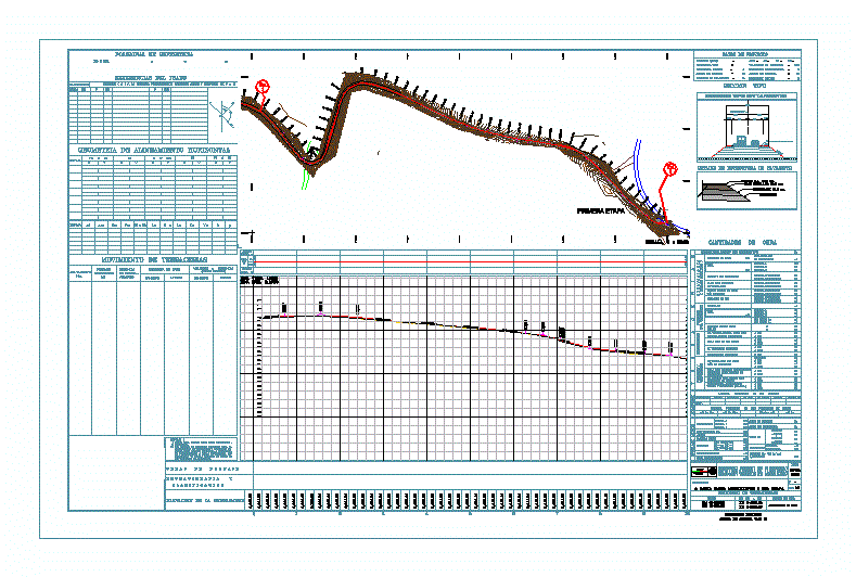
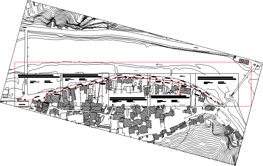
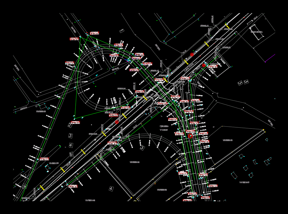
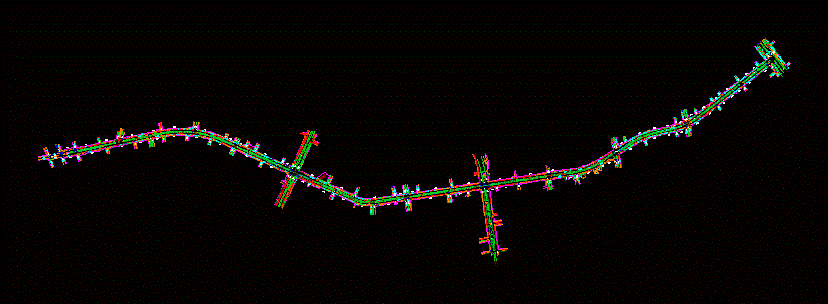
Topographic map of geodesic reference points

Planimetry - level curves - profiles
- Format DWG
- File size 1.55 MB
Related Posts
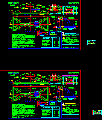
Road construction

Construction plan of a street.
Asphalt pavement
route lighting
Pavement – steps – sanitary drainage

Double lane highway construction
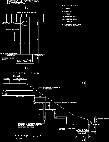
Torrentera – drainage
traffic sink

Roadway cross section – traffic pattern
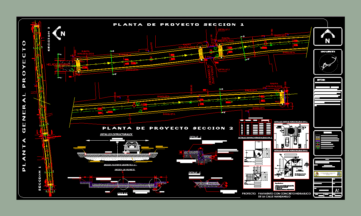
Manzanillo street pavement

roundabouts 2d
carriage trail
collector roads
Garrison cut in road pair scheme
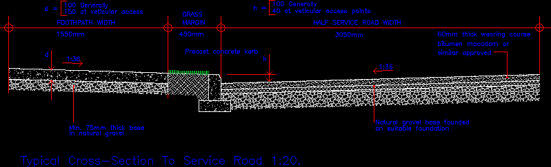
street type section
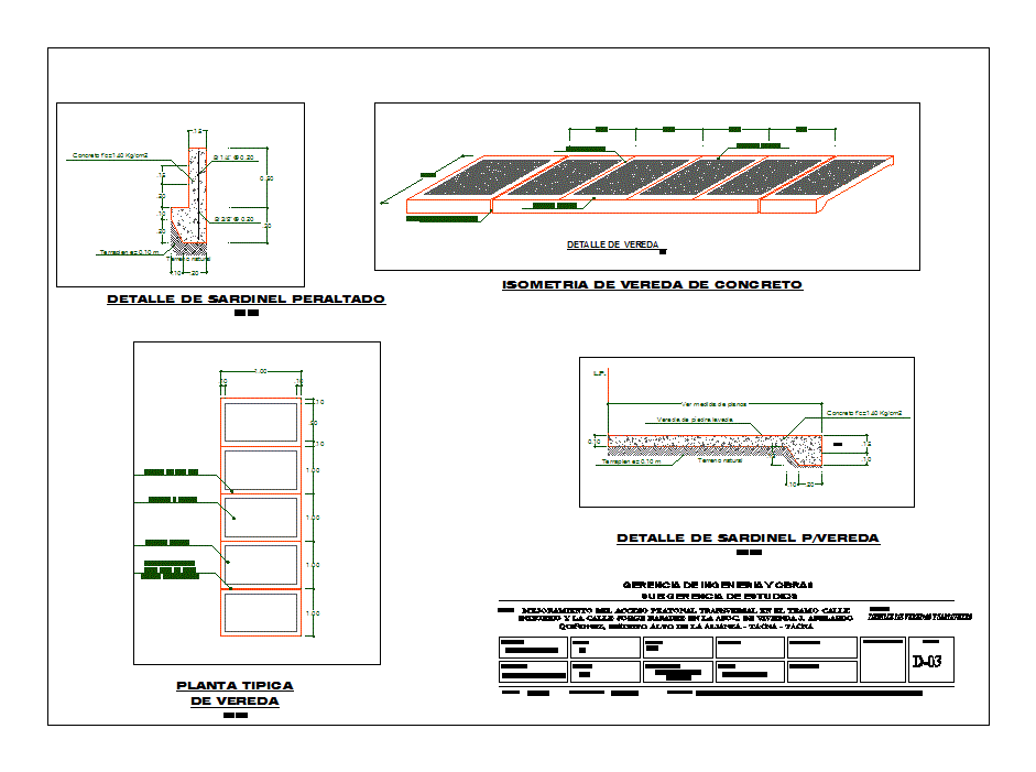
sidewalk detail
Republic Avenue - Venezuela
one way topography
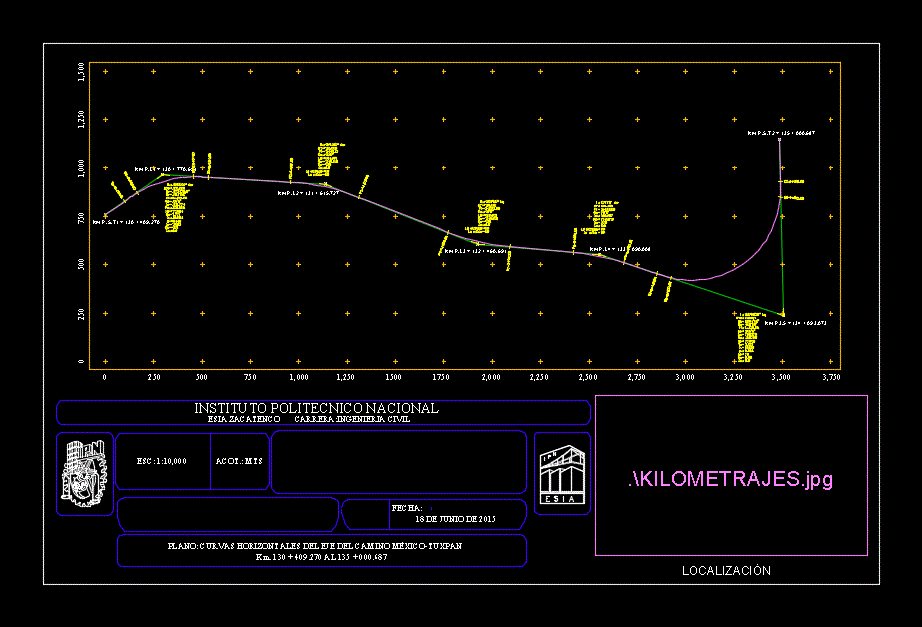
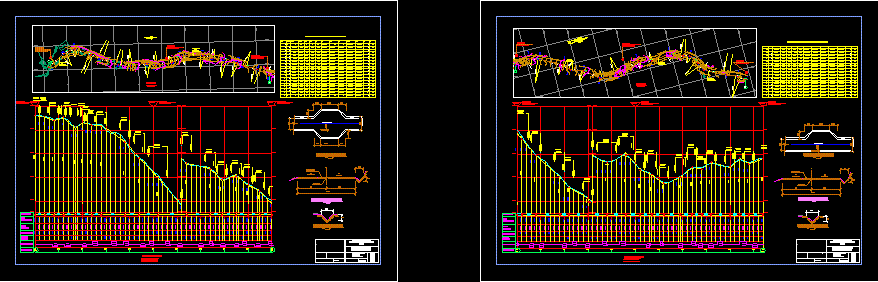
Horizontal alignment – highway mexico – tuxpan