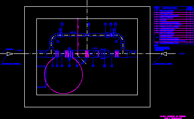
Closed water distribution network

This plane was created from the beginning from the generation of contour lines with the googlemapper; then the layout of the network and the location of each node with its respective heights with the mapsource software; so that finally export it to the epanet
- Format DWG
- File size 1.16 MB
Related Posts
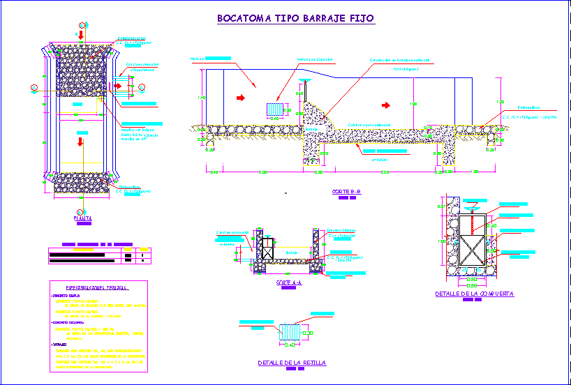
water catchment

Drinking water network project; school project
drinking water meter
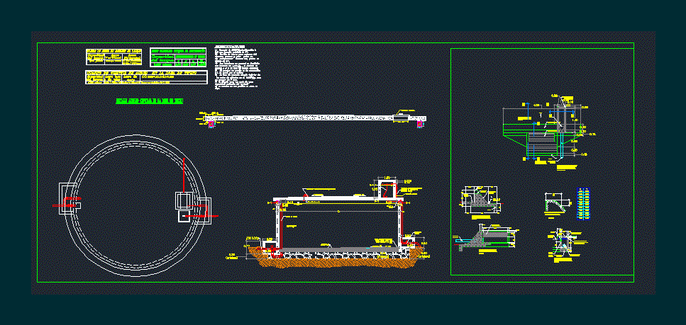
Elevated reinforced concrete tank
Potable water
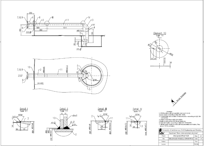
Drain storage tank nozzle
Sanitary installations
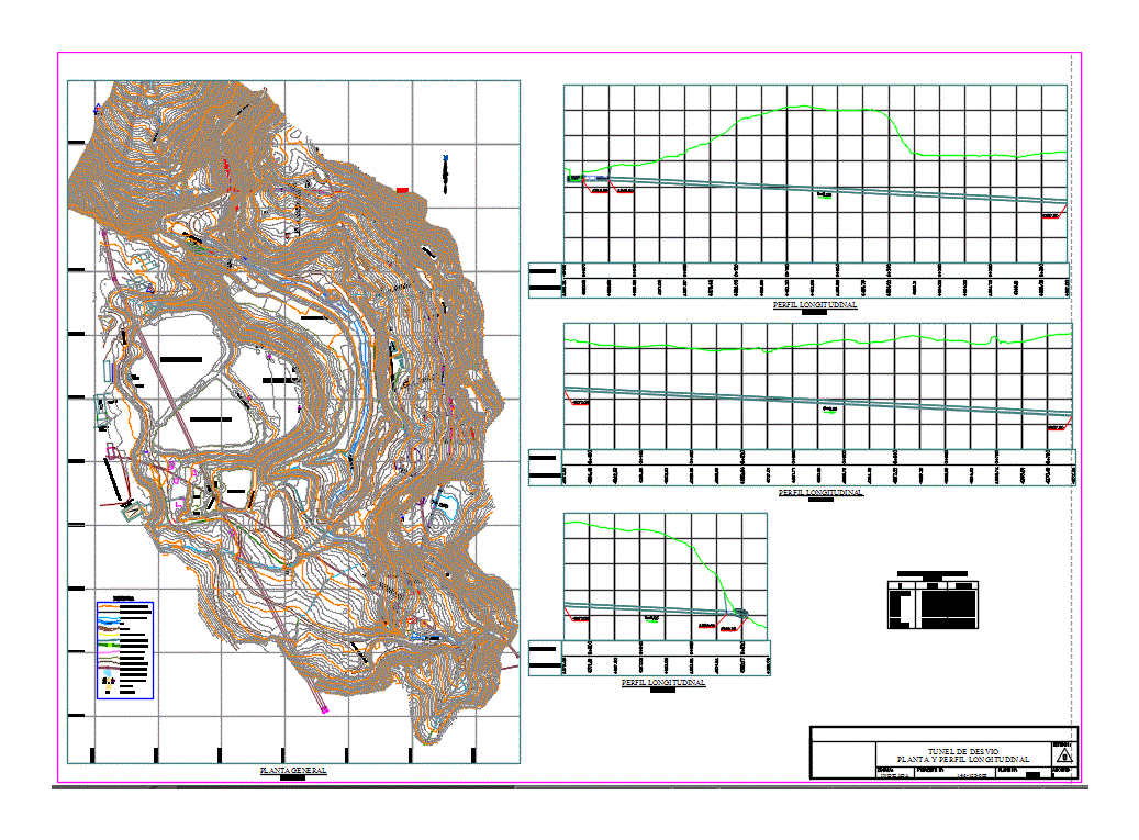
Plan of a channel tunnel
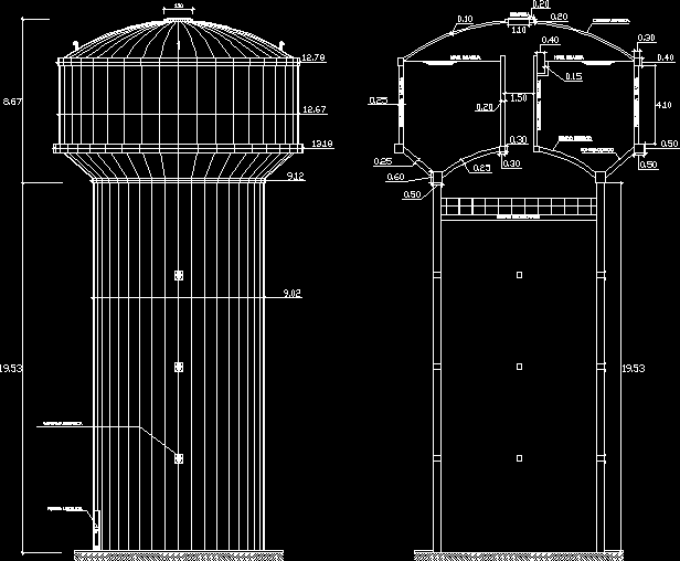
Elevated tank
Aqueduct
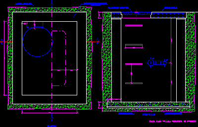
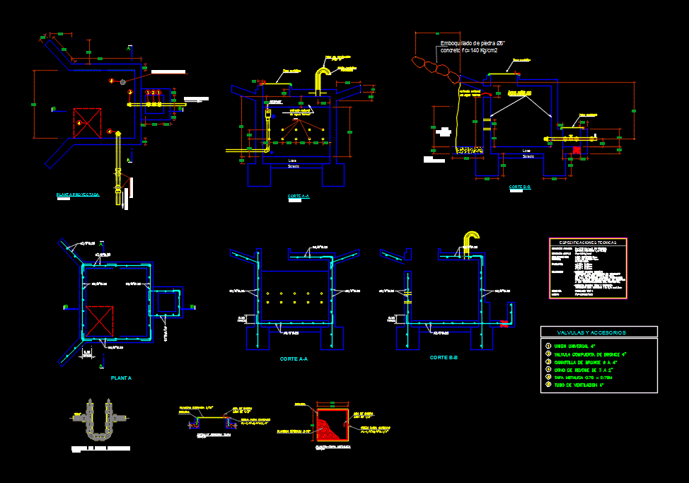
pressure reducing chamber
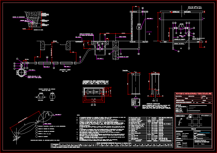
intake plan
Pressure reducing valve
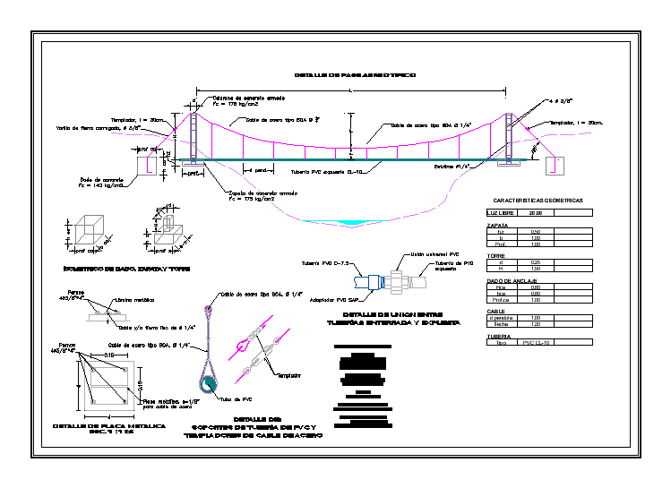
Air pass – details
Drinking water chochope – lambayeque
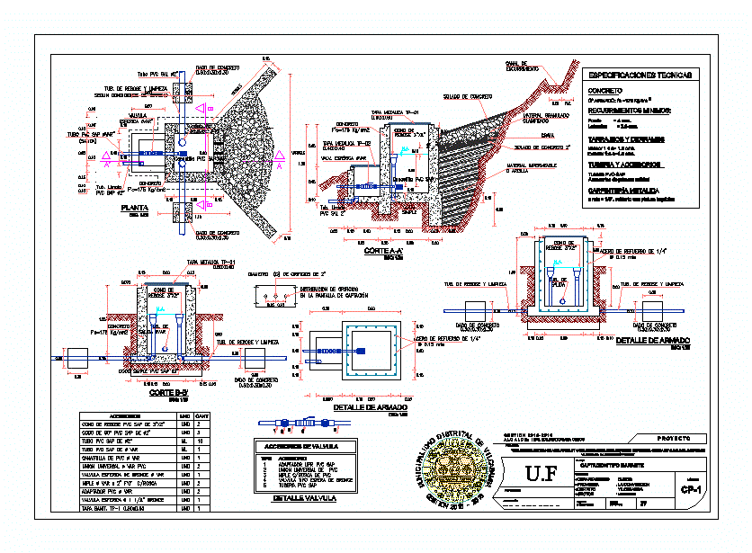
hydraulic catchment
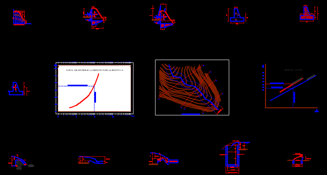
Tyrolean or Caucasian type intake
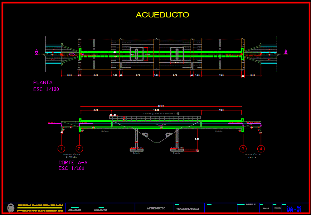
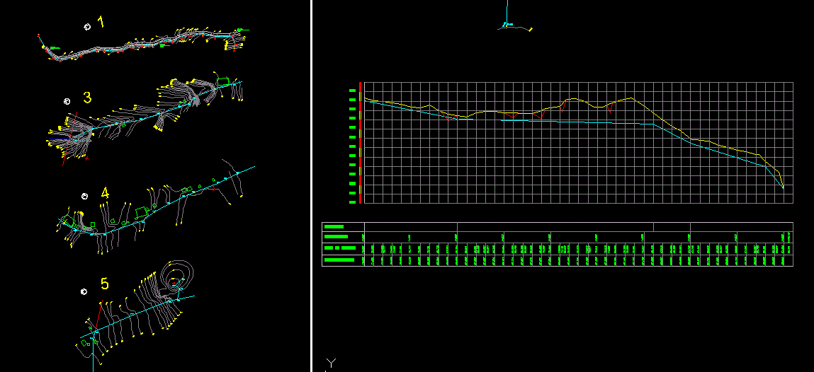
Aqueduct
Formulation of the case of transfer of water from the river desaguadero