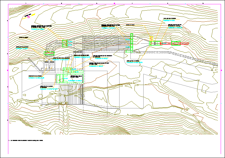
Drinking water network with coordinates

Work done in autocad 2018 with civilcad and gps garmin 350x of a topographic trace for the design of a drinking water network in the cd. from oaxaca mexico
- Format DWG
- File size 2.78 MB
Related Posts
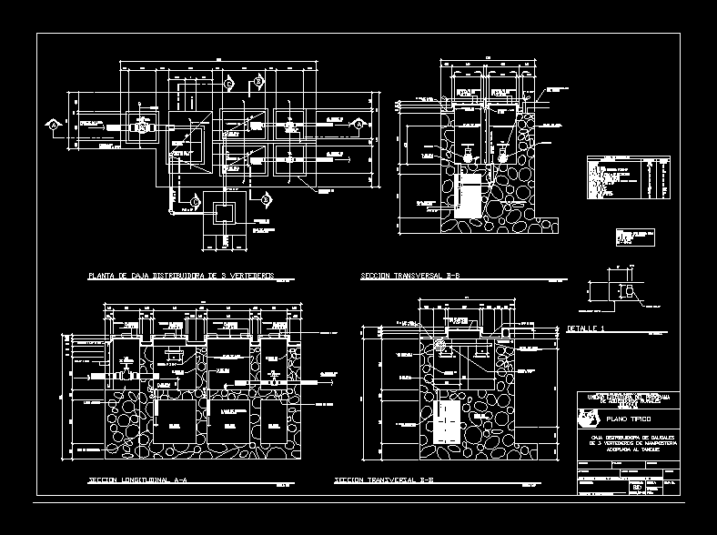
Concrete distribution box for 3 valves
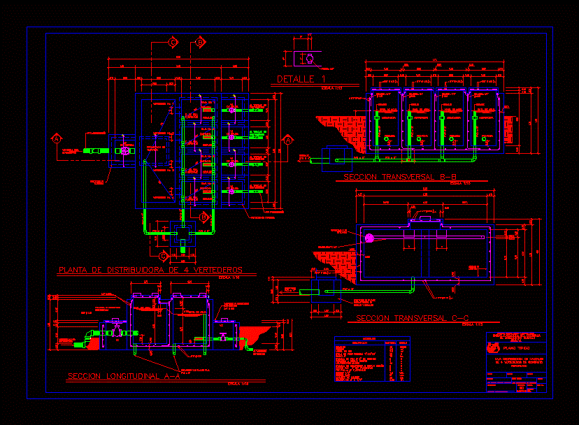
4 weir valve box
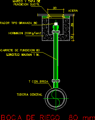
Hydrant
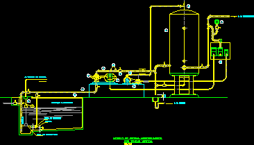
Design of drinking water supply system
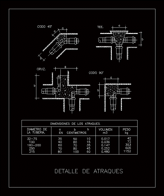
berths
pumping chamber
Catchment
Potable water
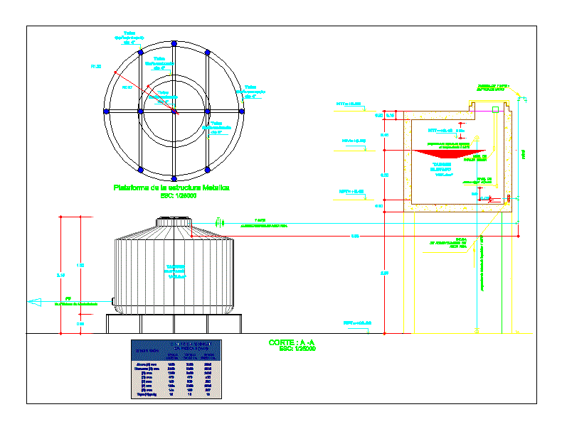
Tank; elevated tank and rotoplast
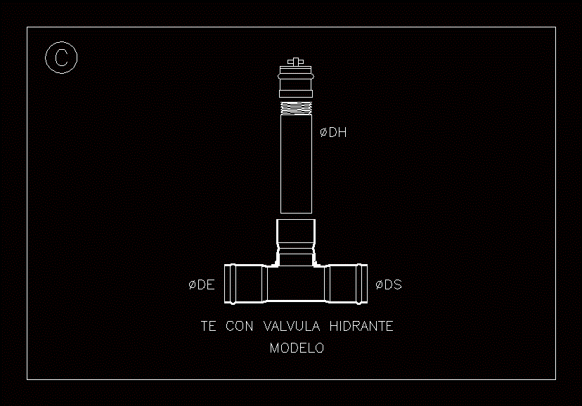
T with hydrant valve
Purging and moisturizing for irrigation

Elevated tank on steel structure tower
City water intake

Elevated Reservoir Architecture
hydraulic catchment

open channel

Urban area irrigation system catalog
Underground catchment - water
Tubular well drilling and equipment